How One Developer Turned OpenStreetMap Data into Playable Minecraft Worlds Using GitHub Copilot

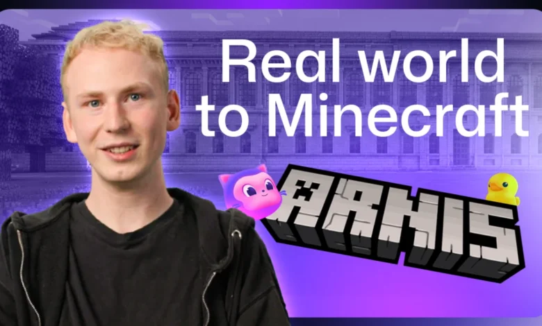
Open-source software development has long been driven by community collaboration, individual ingenuity, and the clever integration of disparate technologies. In 2022, a young developer named Louis Erbkamm combined a childhood
passion for Minecraft with geographical information systems to create Arnis, an open-source project that translates real-world map data into explorable Minecraft universes. What began as a two-week diversion during a school break has since evolved into a globally recognized repository with nearly 900,000 downloads, roughly 70 active contributors, and an expanded scope that now reaches far beyond Earth to the surfaces of the Moon and Mars. Operating as the sole maintainer of the project, Erbkamm relies on modern developer tooling, particularly GitHub Copilot, to manage the overwhelming influx of pull requests, hunt down elusive bugs, and maintain codebase integrity.
The Genesis of Arnis: From a Two-Week Prototype to a Global Community
Erbkamm began coding at the age of 13, consistently seeking innovative ways to bridge the gap between traditional programming and the block-based sandbox environment of Minecraft. In 2022, during a temporary break from his studies, he decided to build a tool that could ingest geospatial data and construct recognizable landscapes block by block. His initial prototype, written entirely in Python, depended strictly on OpenStreetMap data.
Because the early generation process was computationally heavy and notably slow, Erbkamm needed a small, manageable testing ground. He selected Arnis, a tiny municipality in Germany—the smallest town in the country by area. Although Erbkamm has spent countless hours meticulously analyzing its streets, buildings, and surrounding waters through the lens of code and map coordinates, he has never physically visited the location.
"I know where the shops are. Where the boats are… I know the city pretty well, but I haven’t been there yet," Erbkamm noted when describing his unusual relationship with his project’s namesake. The town offered an ideal testing environment because, despite its diminutive size, it contained a dense and varied collection of urban planning elements, including complex road networks, architectural structures, and bodies of water.
As the project evolved, Erbkamm introduced elevation data, transforming previously flat, featureless landscapes into dynamic, topography-rich terrains. This enhancement caught the attention of geospatial specialists and software developers worldwide, who began flocking to the GitHub repository to contribute ideas, translations, and core features. Today, Arnis has been localized into approximately 20 languages and boasts a diverse contributor base spanning multiple technical disciplines.
Technical Mechanics: Translating the Physical World into Blocks
The architecture of Arnis relies on translating complex, real-world geospatial data into standardized gaming assets. When a user selects a specific geographic coordinate or region, the software queries OpenStreetMap to extract every mapped element within those bounds, processing their precise coordinates and categorical types.
While common urban infrastructure such as streets, rivers, and buildings are easily translated into Minecraft blocks, other elements require creative engineering solutions. For example, after noticing a distinct lack of trash bins in generated urban areas during a neighborhood walk, Erbkamm consulted the community to find a suitable in-game block proxy. For monumental global landmarks too intricate for standard map data—such as the Statue of Liberty in New York or Christ the Redeemer in Rio de Janeiro—Arnis employs specialized algorithms to convert complex three-dimensional models directly into Minecraft-compatible voxel structures.
The evolution of the project also saw a major architectural migration. Rather than remaining bound to its original Python framework, the project transitioned to Rust following open discussions on GitHub. This shift allowed Erbkamm and his contributors to significantly boost performance, memory efficiency, and generation speeds.

Managing Scale: The Burden of a Solo Maintainer and the Role of AI
Despite its massive popularity and close to 900,000 downloads, Arnis remains fundamentally a one-person maintenance operation. Erbkamm handles every pull request, code review, and bug fix himself, typically dedicating his evenings and weekends to the project. This imbalance between a rapidly growing user base and a single human reviewer creates significant bottlenecks.
To prevent burnout and manage the administrative overhead of open-source maintenance, Erbkamm integrated GitHub Copilot into his daily workflow. Rather than viewing artificial intelligence as a replacement for human creativity, he utilizes it as an automated administrative assistant and analytical copilot.
"I could delegate those annoying and boring tasks to Copilot, while I could still have a look at those really cool topics that are related to the development of it," Erbkamm explained.
In practice, the tool assists him in examining release notes, tracing the root origins of bugs reported by users, and generating initial fixes. When reviewing massive pull requests that introduce significant structural changes—such as optimizations to lighting engines or street generation logic—Erbkamm leverages the GitHub Copilot app to run background performance reviews. These sub-agents proactively search for micro-optimizations that can reduce memory consumption or accelerate world generation times. Given that a single miscalculated algorithm regarding street lighting can exponentially increase the time required to generate an entire city, automated regression checks have become vital to the project’s stability.
Educational Applications and Classroom Integration
Beyond its technical appeal to software engineers and gamers, Arnis has unexpectedly found a permanent home in educational environments. Teachers around the world have adopted the software to engage students in geography, urban planning, and computer science.
In various classroom implementations, educators task students with generating their local towns or nearby public parks within Minecraft. Students are then encouraged to redesign or improve their virtual environments—such as upgrading a community playground or optimizing local traffic flow—before presenting and critiquing their architectural modifications collectively as a class. By turning local geography into an interactive sandbox, the project bridges the gap between civic awareness and digital creation.
Future Horizons: Beyond Earth and Community-Driven Growth
Recent updates to Arnis have pushed the boundaries of the software far beyond terrestrial cartography, introducing procedural generation support for extraterrestrial landscapes, including the Moon and Mars. Looking ahead, Erbkamm’s primary goals for the project are focused on enhancing generation fidelity, reducing processing times, and expanding its presence in global educational curricula.
For developers, educators, and enthusiasts interested in exploring the software, the repository remains publicly accessible via GitHub under the handle louis-e/arnis. Users can spawn into any location on Earth—ranging from their own hometowns to geological wonders like the Grand Canyon or Niagara Falls—and inspect the generated environment for missing civic details. If a physical bench, building, or pathway fails to appear in the generated world, users are encouraged to map the missing data onto OpenStreetMap or report it as an issue to the maintainer, ensuring that the intersection of real-world geography and virtual gaming continues to grow through collective participation.