The Architecture of Identity: How Biwak.info Solved the Alpine Mapping Slug Problem

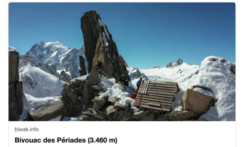
The project biwak.info, a comprehensive digital map dedicated to documenting Alpine huts, bivouacs, and mountain peaks, has recently unveiled a sophisticated URL routing system designed to provide permanent, shareable links for over 42,000 geographical points of interest. Historically, the platform relied on hash-based identification, which functioned as an exact-match search tool but lacked the utility of clean, human-readable URLs capable of generating rich preview cards in messaging applications. By transitioning to a slug-based architecture, the platform now provides stable entry points—such as biwak.info/p/matterhorn—that serve as canonical references for users, hikers, and cartography enthusiasts. This transition marks a significant milestone in the evolution of open-source mapping projects, highlighting the technical complexities of managing decentralized geospatial data at scale.
The Challenge of Ambiguity in Toponymy
The fundamental challenge faced by the developers was the inherent lack of uniqueness in Alpine toponymy. Drawing from the OpenStreetMap (OSM) dataset, which provides the foundation for the site’s 9,429 huts and bivouacs alongside 33,437 named peaks, the team encountered a recurring issue: duplicate naming conventions. In the Alpine region, common names such as "Jagdhütte" (hunter’s hut), "Rosskopf," and "Schwarzkogel" are prevalent, with dozens of distinct physical locations sharing the same label.
Data analysis performed during the development phase revealed the scale of this ambiguity. When attempting to create URLs based solely on names, approximately 15.6% of the database—representing 6,690 distinct locations—would result in collisions. Adding country-level metadata offered minimal improvement, as most duplicates are clustered within the same borders. The introduction of regional identifiers helped reduce collisions, yet even then, twenty-seven instances of "Jagdhütte" persisted within the single province of Carinthia. Ultimately, the development team concluded that no single metadata attribute could provide a universal key, necessitating a multi-tiered, dynamic resolution strategy.
Developing a Robust Slugification Engine
To address these collisions, the team implemented a custom slugification process. The system employs a transliteration layer to handle German umlauts, converting characters like "ü" to "ue" and "ö" to "oe," while folding all other characters into a standardized ASCII format. This ensures that names like "Oberaletschhütte" are consistently rendered as "oberaletschhuette."
Following the initial slug generation, the system applies a cascading hierarchy to ensure uniqueness. The priority sequence begins with the plain name; if a collision is detected, it appends the regional identifier. If the conflict remains, it adds the elevation data. If these measures still fail to resolve the ambiguity, the system defaults to the unique OpenStreetMap ID as a final, albeit less human-readable, fallback. This "shortest unique path" methodology ensures that the vast majority of URLs remain clean and intuitive, with 36,176 of the 42,866 total locations successfully represented by their plain names.
The Role of Regional Context
To ensure the regional identifiers were meaningful to users, the developers integrated Natural Earth administrative boundaries. By utilizing point-in-polygon analysis via the Shapely library, the system assigns a regional context—such as a Swiss Canton, an Austrian Bundesland, or a French département—to every point of interest. In instances where a hut lies precisely on a border or within a simplified coastline, the system defaults to a nearest-neighbor lookup to ensure every point is successfully categorized. This regional tagging not only aids in URL resolution but also enhances the user interface, providing additional context in preview cards and detail views, such as "Biwak · Haute-Savoie, France."
Ensuring Long-term Link Stability
One of the most critical requirements for any digital infrastructure is the prevention of "link rot." If a user shares a URL today, it must remain functional even if future updates to the OpenStreetMap database introduce new, similarly named locations. To solve this, the developers established a "slug registry"—a JSON-based ledger committed to the project’s version control system.
This registry functions as a permanent record of every URL issued. Once a slug is assigned to a specific OSM ID, that association is protected. If a new, competing location is added to the source data, the system prioritizes the established record, ensuring that existing links do not point to the wrong location. This approach creates a stable, immutable registry that survives changes in the underlying source data, providing a level of reliability rarely seen in crowdsourced map applications.
Technical Implications and Database Management
The decision to maintain a human-readable registry has broader implications for project maintainability. Because the registry is stored as a sorted text file, the development team can utilize Git’s diff capabilities to monitor changes in the URL structure. This was particularly useful during a post-launch optimization, where a refinement in the transliteration logic—changing the handling of umlauts—necessitated a re-generation of the registry. By rebuilding the system, the developers maintained consistency while identifying where specific URL structures were modified.
The system also incorporates sophisticated fallback mechanisms. If a user navigates to a URL that corresponds to a shared name, the site redirects them to a search results page containing all matches for that term, complete with their respective types, elevations, and regions. This "search-as-a-fallback" approach prevents dead-end errors and keeps users engaged within the ecosystem. Furthermore, the inclusion of the OpenStreetMap ID within the URL serves as a permanent, immutable anchor; if the primary name-based slug is ever changed, the ID-based URL ensures that the resource remains reachable.
Broader Impact on Alpine Cartography
The transition to this stable URL system serves as a model for other geospatial projects. As open-source mapping continues to gain popularity, the ability to reference specific points with permanent, indexable, and human-readable links is essential for both accessibility and academic research. By effectively balancing the need for intuitive naming with the requirements of strict data uniqueness, biwak.info has lowered the barrier to entry for users seeking information on specific Alpine terrain.
The project’s reliance on OpenStreetMap, while powerful, presents a unique challenge: the data is constantly evolving. Unlike static databases, the collaborative nature of OSM means that information is frequently updated, corrected, or expanded. The implementation of a stable registry, combined with automated geometric lookups for regional data, provides a resilient framework that can withstand the fluidity of crowdsourced data.
As the platform continues to scale, the developers have noted that the current approach is sustainable for the existing 42,000 points. Future iterations may need to account for larger datasets or more granular geographical boundaries, yet the foundational logic remains sound. The success of this implementation suggests that even in the complex world of mountain topography, where names are as varied as the peaks themselves, order can be successfully imposed through thoughtful engineering and a commitment to data permanence. In doing so, biwak.info ensures that every hut, bivouac, and peak remains a fixed point in an ever-changing digital landscape.